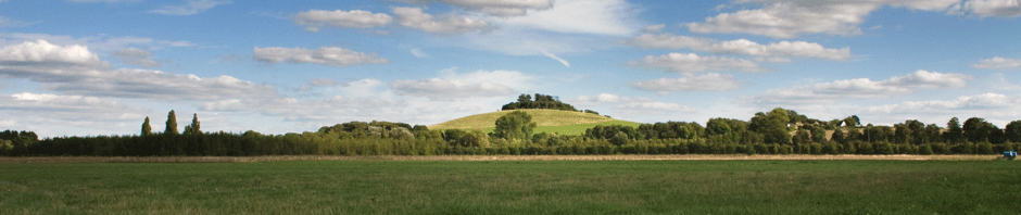
 Fresh momentum has been injected into the search for new footpaths and cycling routes between Long Wittenham and Clifton Hampden.
A team of parish councillors and residents has been revived after seven years. Previous efforts were thwarted by landowners and farmers worried by damage to crops and disturbance to grazing sheep and cattle. But it’s hoped that new landowners could be more receptive to the creation of routes for walkers and cyclists.
The group comprises Gordon Rogers, chairman of Long Wittenham Parish Council, Glenn Pereira of Burcot and Clifton Hampden Parish Council, Tom Bowtell and Keith Tucker, residents of Long Wittenham, and David Scott, resident of Burcot.
The group is examining several options including a cycle-path-cum walking route alongside the main road between Long Wittenham and the Barley Mow. Talks were opened with Oxfordshire County Council but this has fallen by the wayside on the grounds of engineering difficulties, purchase of land and disruption to traffic. The group will seek meetings with landowners to see if a cheaper option is possible.
Another idea is a route across the fields from Northfield Lane towards the Barley Mow car park. Earlier talks with several previous landowners were abandoned when the idea was opposed. The group is also examining the possibility of a path from Long Wittenham to cross the weir at the end of the back-water, over the island with a link to the Thames Path and on to Clifton Hampden Bridge.
Parish council chairman and member of the footpath group Gordon Rogers said: “For years both communities have been seeking ways to improve cycling and walking routes. Now there is fresh impetus from the government in the wake of the Covid-19 pandemic as the Green transport revolution takes root. There are new landowners in the area and we hope they will be more sympathetic towards our objectives.”
The revived group has won support from Long Wittenham’s District Counciilor Sam Casey-Rerhaye. She said: “I am really pleased that this group is trying to find a workable route for walking and cycling. It’s vitally important that villages have safe connections so that we can improve our health and well-being. As Cycling Champion for South Oxfordshire District Council I will help the group in any way I can.”
I hope this can be achieved. Good luck.
What is wrong with the route past Bodkins, past New Barn Farm, then left down to the river, where you turn left and come out at Clifton Hampden bridge. Whenever I walk or cycle to Clifton Hampden I always go that way. All on PRoW.
The off road section is technically footpath and apparently there have been complaints to the Earth Trust about cyclists using it. It’s also quite circuitous. That said it’s much safer for children and I always use it when with the kids… sorry, rather have unhappy walkers than a texting driver plough into the back of us at 60mph.
Excellent. This is really needed. Think the river/weir route would be too far & is the longest way round. Hope it happens after all these years of waiting & waiting.
Simple solution which I suggested to OCC and they were apparently “considering” (make of that what you will” is to do what they do extensively around Newcastle and Durham. Scrub off the centre markings (they are mostly worn off anyway) which has already been proven to reduce speed through villages but then paint two wide cycle lanes either side of the road.
The cycle lanes would also provide a defacto safe space for pedestrians.
When they have used this elsewhere it has bought median traffic speeds down to circa 30mph.
Of course motor vehicles usually use the cycle lanes so there is no loss of capacity, but it’s clear that the space is prioritised for cyclists and pedestrians and motor vehicles should *expect* them to be there – anyone who’s walked along that road knows motor vehicles don’t expect you to be there and barrel around the corner at 60mph.
It would be cheap and would get around land ownership issues overnight. It just needs a bit of imagination from the council to realise this is a key connecting route not just for cyclist commuters between Didcot, Culham and Oxford, but also it is an unclassified village road linking us with the GP surgery and shop. Not a 60mph race track-cum-rat run.
As for the suggestion to run via Bodkins, this is a good idea for leisure cyclists but realistically it would add quite a lot of distance for commuters, and vehicle speeds are often little better along that road although of course much quieter. The “Slow down” signs are there for a reason – multiple complaints I understand.
I would like to support the sensible and practical proposals made by Chris Waite regarding a cycle/pedestrian route designation on the main road to Clifton Hampden. Removal of central white lines, which creates a more rural appearance, has been shown to reduce speeds in other countries. At a time when OCC funding for this project is available, and it is supported by environmental concerns & District Councillor, it seems a prime opportunity after many years to secure a proper cycle route on the main road, which is more likely to be a desired route by both commuters and “leisure cyclists”. The pedestrian aspect of this is important, for those wishing to access the surgery or shop.
It should be established as a priority where any funding would come for future maintenance of such a route. The “Sustrans” model for the cycle route to Didcot was for a one-off grant, future maintenance being uncertain, in the main falling to landowners/ Parish Council (eg the width restrictions at Acklings). It should be ascertained whether OCC would offer future maintenance of a main road facility; the Northfield Lane footpath route is perhaps more likely to fall to the Parish /landowners to maintain.
Certainly a rural route such as Northfield Lane would be popular with “leisure cyclists”; however, the route is already much used by horse-riders and ramblers/walkers, and while I am sure village users would be sensible, we do see large groups of visiting “leisure cyclists” travelling to/from Little Wittenham who travel in large groups and at some considerable alarming speeds. Is the Parish Council plan to designate Northfield Lane footpath a bridleway still pending?
A final point to factor in is that it is not often understood that the Lane is already a route for a considerable volume of a variety of regular heavy agricultural traffic, ranging from combine harvesters to 40 foot articulated lorries at different times of year.
Quite right. The idea that it is too dangerous for cyclists to mix with cars on a full width road but perfectly safe on a narrow road with agricultural vehicles is somewhat counterintuitive.
Just runs back to the core issue that people wanting to drive between Didcot and Oxford should be aware the road between CH and Lw is a village road, not the A34. Pedestrians and cyclists should come first.
Well said, Chris!
I agree with the above and live in hope that we can have a solution before too long.
I would also press for our cycle track to Didcot to have the vegetation cut back and some of the terrible holes filled in. Last time I cycled it there was barely a foot between the edges. Certainly no place to pass a pedestrian or another cyclist.
Jane’s comments re Northfield lane are spot on. There are significant risks attached to it’s use. It should also be borne in mind that Northfield Lane is officially designated as a public footpath between Little Wittenham road and the grey barn which as I understand it, ( but I maybe wrong) means that it isn’t a PROW for cyclists (or motor vehicles come to that).
It would be good to find a solution for this, but it seems to me that whatever is done will be expensive and because of that, I suggest that the actual demand should be quantified in detail. What percentage of villagers (LW and CH) would actually use such a path? Where are other users coming from/travelling to? For what purpose? How many of them are there? Does the proposed scheme to connect Didcot to Culham have any effect? I think that question such as these should be answered before any binding decisions are made. I cite the cycle path that was established on the CH to Berinsfield Road at signifiant expense to the council tax payer and is now virtually unused should be borne in mind.
On a final note, I like Chris Waites approach to modifying the road between CH and LW as it would have a general slowing effect on traffic between CH and LW and in the village.
Just to say that I am impressed with Chris Waite’s suggestions about modifying the white lines on the road between Long Wittenham and Clifton Hampden, and what that might achieve at relatively low cost.
I also agree strongly with Les Ormonde’s wise questions about the users and their purpose: “What percentage of villagers (LW and CH) would actually use such a path? Where are other users coming from/travelling to? For what purpose? How many of them are there? Does the proposed scheme to connect Didcot to Culham have any effect?” I think that understanding the answers to those questions would go a long way in helping us to decide the most appropriate solution.
As a final comment, I cannot see why the Northfield lane route could not be upgraded from FP to Bridleway; especially if there are funds available for improvements. Change is possible, but it does depend, as Les Ormonde says, on who are the users, why do they use it, where do they come from. These are good questions, and if answered, might help us progress wisely.